Posts Tagged ‘tech-tips-1’
Behind the Story: How the marketing of Oxycontin trumped science

For more than a year, the Milwaukee Journal Sentinel has been investigating prescription drugs and the dangerous side effects of using opioids ot treat chronic pain. The latest installment of the series tracks the lives of chronic pain sufferers who praised the drug in a 1998 promotional video. Milwaukee Journal Sentinel reporters John Fauber and…
Read MoreThe benefits of using data in your reporting
Alex Remington, a research assistant for Journalist’s Resource and a Harvard Kennedy School graduate student, sat down with Steve Doig, Knight Chair in Journalism at the Walter Cronkite School of Journalism and Mass Communication at Arizona State University, to ask him about the pros and cons of doing data journalism. Doig thoroughly recounts the limits…
Read MoreThe 2012 IRE Conference tiphseet and presentation CD now available
Even though the IRE Conference has come and gone, you can still access all that valuable information from the tipsheets and presentations we compiled. With over 100 files available you’ll have all the tips and tools you need for not only your daily reporting but also long-term projects. Available on one handy CD, you can…
Read MoreJoin more than 1,000 colleagues at IRE Boston next week
More than 1,000 people are registered to attend the IRE Conference in Boston next week, and it’s not too late for you to join them. While early-bird registration has closed, you can register at the conference. Things kick off with a free half-day session on election coverage on June 13, the pre-day on June 14, and…
Read MoreBehind the Story: Firefighters disabling the city’s budget

Photo credit:Elie Gardner/Post-Dispatch Social media can be an individual’s nightmare and a reporter’s goldmine. In “Disability pensions allow some firefighters to collect while working elsewhere,” St. Louis Post-Dispatch’s reporters used an array of investigative tools to publicize a mismanaged disability pension system that is eating away the city’s funds. But even when firefighters are capable…
Read MoreBehind the Story: Investigating questionable police work when documents are redacted
One of the redacted documents California Watch received. In California Watch’s series Broken Shield, Ryan Gabrielson uncovered abuse and unknown injury cases at developmental centers that weren’t reported to the local police or district attorneys’ offices. Despite a number of condemning reports and a decreasing patient population, the number of abuse and unknown injury cases…
Read MoreSelden Ring Award winner to speak at Spokane workshop
Photo credit: USC Annenberg School for Communication & Journalism Congratulations to Michael J. Berens and Ken Armstrong of The Seattle Times, for receiving the 2012 Selden Ring Award for Investigative Reporting, for their series “Methadone and the Politics of Pain.” Berens will be speaking at IRE’s Watchdog Workshop this weekend in Spokane, Wash. Berens and…
Read MoreMoving a story beyond the data dump
By Hilary Niles @nilesmedia Some of the pithier annectdotes from this year’s conference surely belong to Tony DeBarros, Ron Nixon and Ben Welsh, for their presentations during “Making sure you tell a story.” Their three presentations, in rapid succession, covered ground from story craft to news strategy to robotics, and still managed to present a…
Read MoreTools, slides and links from NICAR12
IRE will be collecting tipsheets from the conference and storing them in the Resource Center for members to search and download. Chrys Wu, a journalist and engagement editor, is collecting online resources from the conference, as she did during the 2011 CAR Conference. Here is the beginning of her online post: One of the most popular posts…
Read MoreBehind the Story: 10 years in, safety concerns still plague nuclear waste site
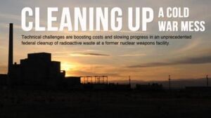
In “Problems plague cleanup at Hanford nuclear waste site,” USA Today’s Peter Eisler takes on 56 million gallons of radioactive waste and finds he isn’t the only one who has a few things to learn. After 10 years of developing the “first-of-its-kind” nuclear waste treatment plant, the Department of Energy and its contractors still don’t…
Read More