Editor's Note: As the Yarnell Hill Fire continues to blaze, mourning begins for the lives of 19 firefighters lost in the battle. Reporters are beginning to dig into why this disaster happened. Nate Carlisle, justice editor at The Salt Lake Tribune, has covered wildfires since 2005 and completed a weeklong wildland firefighter certification course. He offers some advice and suggests questions for those wanting to investigate this and other fire tragedies.
- Don't assume this fire was some unstoppable, freak occurrence of nature. Wildland firefighters are trained to assume every fire is about to rage out of control. That's why there are safety protocols. (For example, see the Standard Firefighting Orders listed below.) Were the protocols followed? If not, why?
- Remember to treat these deaths as workplace deaths as much as natural disaster deaths. Everything you know, or IRE has taught you, about covering deaths on the job applies here.
- Learn the lingo. Wildland firefighting has a vocabulary that can be different than what you're used to hearing from your city firefighters. The Santa Barbara Independent in 2008 published a good reference. http://bit.ly/14J6Zy8
- What was the "Sizeup Report" when the hotshots arrived on scene? A hot shot crew is typically defined as a team of about 20 wildland firefighters with advanced training in suppression. They carry a variety of hand tools as well as chainsaws and torches. The Sizeup Report should have included whether it was a wildland or structure fire -- it could have been both in this case -- and the size of the incident, its status (flames showing, smoldering, etc.), who has command of the incident and where that person is, weather, radio frequencies, best access routes, special hazards or concerns and what additional resources are needed.
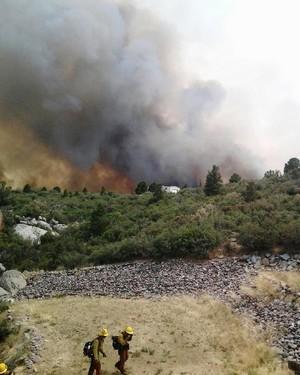
- What was the topography? If the hotshots were working on any kind of a slope, there are supposed to be extra safety protocols. Wildfires move faster uphill than down. Canyons or chutes can draw the fire uphill quicker than a broad slope. This webpage from the California Professional Firefighters gives a quick overview of topography and how it influences fire. http://bit.ly/12Cg6xo
- If the hotshots where on a slope, which way was it facing? South-facing slopes are more exposed to the sun and have more fire activity.
- What were the fuels? Tall timber fires are what a few bad movies have been made from, but grasses and shrubs burn faster and hotter.
- Who was watching the weather or advising the hotshots of the weather, especially wind?
- What was the radio traffic?
- What kind of vehicle support (fire engines, airplanes, helicopter, etc.) did the hotshots have and what did they request?
- Had any previous fire mitigation been done in this area? If so, then by who? Mitigation can include the clearing of downed or living trees, clearing of native or invasive grasses, the planting of fire-resistant grasses and plants or just regularly watering the surrounding area so it doesn't burn so easily. The city or county might have someone in charge of fire mitigation. Talk to that person and ask for documentation.
Standard Firefighting Orders, courtesy National Wildfire Coordinating Group Incident Response Pocket Guide, PMS 461, NFES 1077, January 2010. PDF found here: http://bit.ly/MoPDvR
- Keep informed on fire weather conditions and forecasts
- Know what your fire is doing at all time.
- Base all actions on current and expected behavior of the fire.
- Identify escape routes and safety zones, and make them known.
- Post lookouts when there is possible danger.
- Be alert. Keep calm. Think clearly. Act decisively.
- Maintain prompt communications with your forces, your supervisor, and adjoining forces.
- Give clear instructions and be sure they are understood.
- Maintain control of your forces at all times.
- Fight fire aggressively, having provided for safety first.
Live wildfire map Powered by Esri


